This 62 km self-guided tour starts in Toora.
This self-guided tour allows you to find your way through the tall forests that lie just to the north of Foster and Toora in the lush, steep Strzelecki State Forest. It is ideal in warm or cold weather, so spend a day exploring our hills and stay overnight in Foster or in one of our nearby communities.


From Toora, the tour travels the Toora-Gunyah Road, via the Mount Fatigue lookout, to the magical Gunyah forest, and then turns west along the Grand Ridge Road with its historic sites. A left turn at Gunyah junction onto the Foster-Boolarra Road leads back to the South Gippsland Highway near Foster.
Some tour tips:
- Check you have enough petrol, food and water for the journey as there aren’t any shops up in the hills
- Don’t count on your mobile phone working
- The roads are narrow and windy – just drive slowly – keep under 30 kph and keep left
- Watch out for logging trucks every day except Sundays
Set your trip meter to zero at the Toora Post Office and follow the guide below:
| 0 km | Head north up Toora’s main street (Stanley Street). Turn left onto the South Gippsland Highway and straight away turn right onto Creamery Valley Road (virtually opposite Stanley Street), towards Mt Best. |
| 4.8 km | Franklin River Road on left. Follow the bitumen as it veers right and crosses Tin Mine Creek. |
| 5.0 km | Intersection. Turn left onto Toora-Gunyah Road and continue to follow this road. Bitumen ends. |
| 10.3 km | Mount Best. Turn right to stay on the Toora-Gunyah Road, then veer left onto the low road. Keep following the signs that point to Mt. Fatigue and Gunyah. Nearby is the site of Mount Best school, closed in the 1980s. |
| 10.6 km | The peak straight ahead is Mt Fatigue, at the southern edge of the Strzelecki State Forest. |
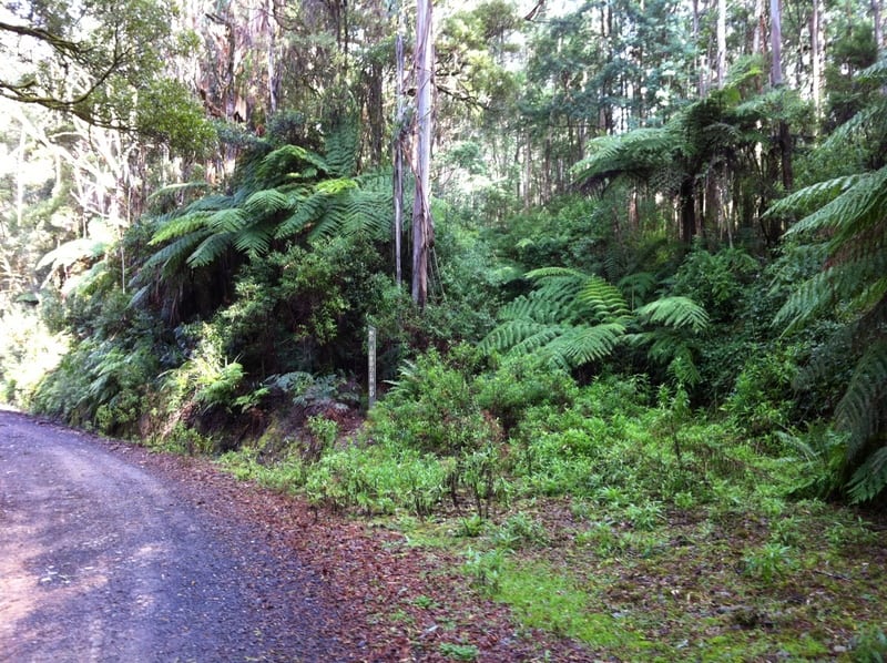
| 12.6 km | The edge of the Strzelecki State Forest. Wind down the windows and slow down to 30 kph or less. You have entered the shelter of the forest microclimate. Tree ferns, Mountain Pepper, Epiphytes, Blackwood. |
| 12.9 km | Beautiful deep gully on left. |
| 13.4 km | A nice patch of Mountain Correa on the right. |
| 15.1 km | A good spot to pull over and explore. Musk Daisy Bush, Christmas Bush, Austral Mulberry, Rough Tree ferns, Tree Lomatia, Mountain Pepper, Prickly Currant Bush, Blanket Leaf, Messmate and Blackwood over storey. |
| 15.4 km | Smooth trunked Mountain Ash start to appear amidst the bark covered Messmate trees. Purple Flax Lily, Epiphytic ferns. |
| 16.5 km | Mt Fatigue turnoff. Turn right onto the Mt Fatigue Lookout road (1 km each way). Musk Daisy Bush, Kangaroo Fern, Messmate. |
| 17.5 km | Mt Fatigue Lookout. This is one of the best views in the district. There’s a picnic table in the rotunda.
Retrace your steps to the Toora-Gunyah Road. |
| 18.5 km | Turn right back onto the Toora–Gunyah Road, heading north through deep mountain forest. The Franklin River catchment is on the left, while on the right is the catchment of the Agnes River. |
| 19.2 km | There’s a good spot to park on the left and explore on foot. Austral Mulberry, Musk Daisy Bush, Dogwood, Bootlace Bush, Hazel Pomaderus, Clematis Vines, Ferns, Wire Grass, Mountain Ash. |
| 19.9 km | Devil’s Pinch Road is on the right. Good for a walk. |
| 20.65 km | Lower Devil’s Pinch Road. Good for a walk. |
| 21.5 km | 1997 logging track on left. Replanted with non-local Blue Gum. |
| 21.8 km | Another track leading to a 1997 logging coup on left. |
| 22.1 km | Red Hill track on left. Another 1997 logging area where a mixture of old growth, 1914 re-growth and 1977 re-growth Mountain Ash, Blackwood and Wattle trees were cut, the area bulldozed and burnt and replanted with non-local Blue Gum and Shining Gum – the kind used for paper. These areas are now claimed as plantation. If you wish to explore any of these tracks, park the car and walk. |
| 22.85 km | Evans Track on left leads to more 1997 logging coupes. Amongst the young Blue Gum can be found the dead ‘toehold tree’, with toeholds cut up the trunk, thought to be made by Aborigines in order to reach a hollow which may have contained possums, gliders or honey. It is hard to find and involves a 3 km walk. |
| 23.5 km | On a bend which curves to the right there is a semi-hidden short walking track on the left which leads to the ‘Big Tree’. Please treat this marvelous old treasure with the utmost respect and avoid the temptation to climb over its roots or into its hollows. On the track, see Tender Brake, Mountain Pepper, young stands of Mountain Ash, Muttonwood trees, Hazel, Myrtle Beech, Prickly Currant Bush, Hard Water Fern, Dogwood and Blackwood trees. |
| 23.9 km | There’s space to park the car near the big hollow Mountain Ash on the right. This is ancient cool temperate rainforest, ranked amongst the four most significant rainforest sites in Victoria. Myrtle Beech, Ferns, Mosses, and Fungi. |
| 24.6 km | Stronachs Road to the left leads to more 1997 logging coupes. |
| 25.5 km | Mixture of Mountain Ash old growth, re-growth from the 1914 fires and re-growth from 1977 logging. |
| 25.9 km | You have reached the Grand Ridge Road. Veer left along the Grand Ridge Road and continue through wonderful bush. The Grand Ridge is the backbone of the Strzelecki ranges. North of the Ridge, creeks and rivers flow down towards the Latrobe River, and onto the Gippsland Lakes. Some water is diverted into the Latrobe Valley power stations and paper mill at Maryvale. Alternatively, a right turn leads to Rytons Junction, English’s Corner and on to Tarra Bulga. |
| 26 km | On the left, the site of the Gunyah Central State School (1907-1941). Adjacent to the site was once a paddock where pupils would leave their horses during classes. Through the trees on the right, a large logging coup can be seen. |
| 27.3 km | On the right is the site of the old Gunyah Hotel, which burnt down in 1941. |
| 27.8 km | West Branch Track on the right. Listen for Lyre Birds going through their incredible vocal gymnastics. |
| 29.6 km | The ‘Springboard Tree’ on the right is the one which Jack Patterson climbed to a height of 50 metres in 1927. The grooves where he wedged his boards into the tree can still be seen. On the left is the site of the old rifle range. Rifle shooting was a popular sport early in the 19th Century and was subsidised by the government. |
| 30.6 km | The site of Gunyah Gunyah School, which operated from 1907 – 1925. |
| 30.8 km | Gunyah Junction. Turn left down the Boolarra-Foster Road toward Foster. Stay on this road for its full length. |
| 31 km | To the left is Turtons Creek catchment. This creek meets the Tarwin which flows to Andersons Inlet, near Inverloch. The left side of the road is the Franklin catchment. Human disturbance becomes more apparent the further south you get. Young stands of Mountain Ash re-grown after logging in the late 1970s, Wattle forests, Dogwood forests, Blackwoods, Grey Gums, Pine plantations. The road was upgraded to handle 90 log trucks a day, Most pine and Ash logs head north to Morwell, which has Australia’s biggest and newest hardwood sawmill, as well as a large pine sawmill. Near Morwell is Australia’s biggest paper and cardboard mill, which consumes large amounts of both pine and native ash logs. Only a few small sawmills are left in the district. |
| 36.4 km | Here is the site of the Booolarong State School – 1906-1940. Blackwood and Silver Wattle. |
| 42.2 km | Turtons Creek turnoff on the right. |
| 44.5 km | Wonga Square Top turnoff on the left. |
| 46 km | Small clearing on the left is suitable for a picnic. |
| 50.5 km | T intersection. Turn right onto the Foster-Mt Best Road towards Foster. |
| 50.6 km | Strzelecki Warm Temperate Rainforest on the right (private property). Sweet Pittosporum. |
| 52 km | Turn left onto the South Gippsland Highway to return to Toora – or turn right to go to Foster. |
| 53.2 km | Port Franklin River turnoff on the right. At Port Franklin, the Franklin River meets Corner Inlet. |
| 58.3 km | Bridge over the Franklin Rivere. This short but sweet river begins up at Gunyah and ends at Port Franklin. Our trip has more or less circled the Franklin River upper catchment. On the left, a picnic area with public toilets. The Franklin is just one of the many river valleys that wind down from this State Forest. |
| 62 kms | You’re back in Toora. |